This article has been updated [15 August 2023] to take account of, you’ve guessed it, the latest crashes.
So said a number of locals at a meeting to discuss safety called by local councillors, Patsy Cummings and Nina Degrads. Why should so many people unconcerned about safety turn up to a meeting to discuss safety? Could they be worried that the only sensible solution to promote safety would involve restricting motorised traffic? There were also other locals who recounted their observations of danger, including a young father who relayed that his children were too frightened by traffic to wish to walk independently to school.
As well as ‘lived experience’, another way of assessing safety is to look at the facts.
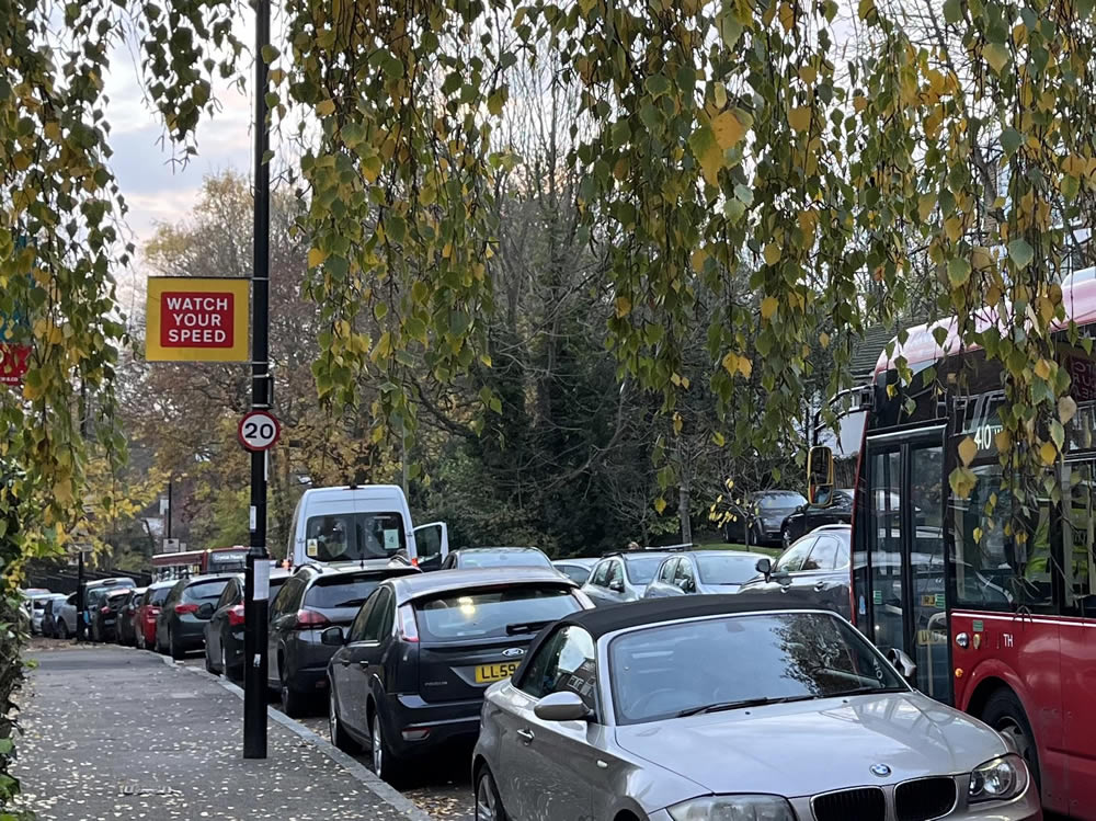
Speed
Every month, top speeds of at least 50mph are recorded by the Speedvisor opposite the entrance to Stambourne Woods. The highest recorded is 70mph [i], but probably more worrying is 45mph recorded while pupils were going to school [ii].
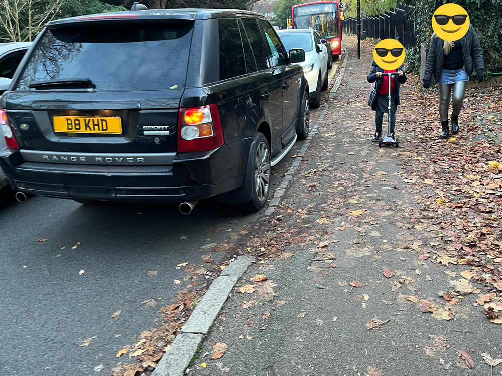
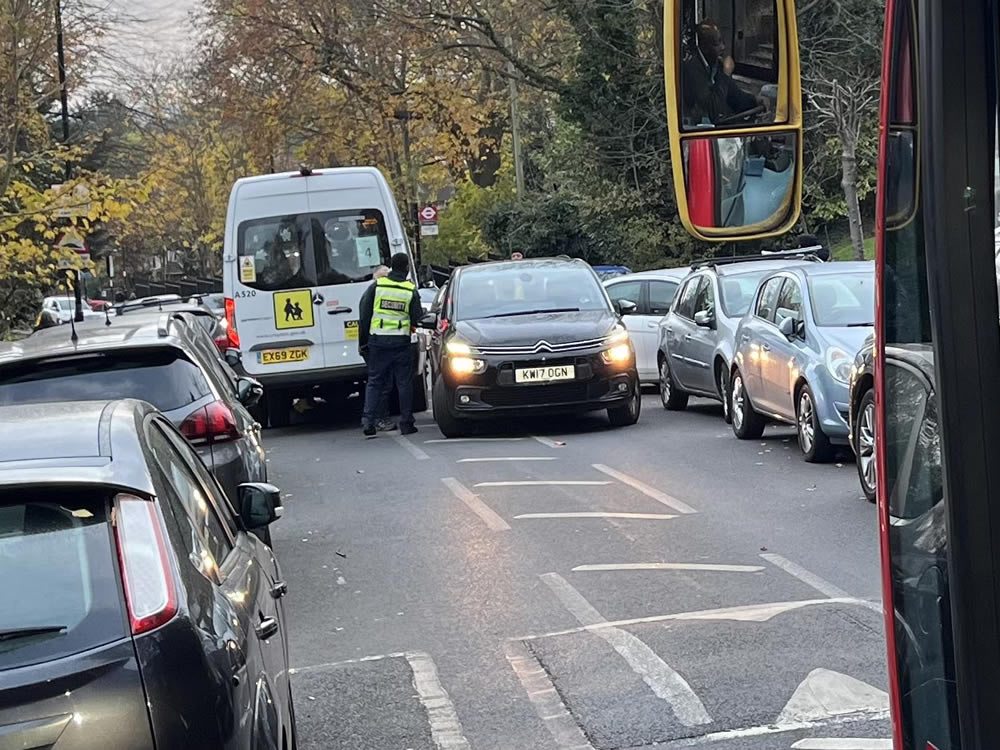
Rat-run
Auckland and Lancaster Roads, together with feeder roads such as Southern Avenue are prime rat-run roads between the main ‘A’ roads Anerley Road, Church Road, South Norwood Hill and High Street. As such they experience high volumes of traffic inappropriate for the lowest classification roads (Auckland is classified a ‘C’ road, Lancaster and Southern are not even classified). The psychology of rat-run drivers is yet to be studied, but we can assume that saving time, despite the unpleasantness of speed bumps is a priority, so speed is of the essence.
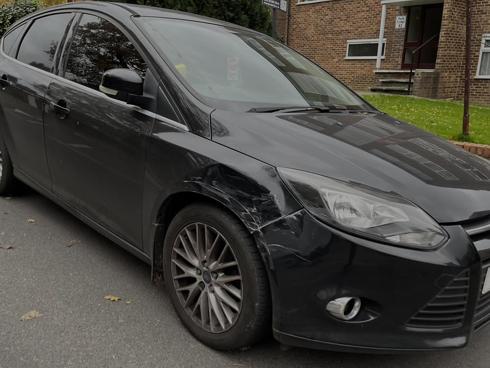
Crashes
In a road with a 20mph speed limit, you would think it is almost impossible to crash. However, here’s evidence of the frenzy endured within the now defunct Auckland Road Low Traffic Neighbourhood that did so much to reduce and calm traffic.
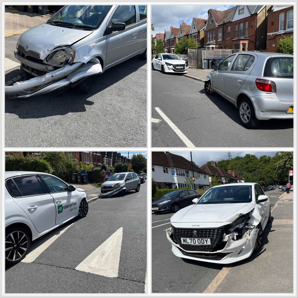
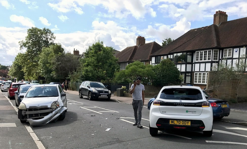
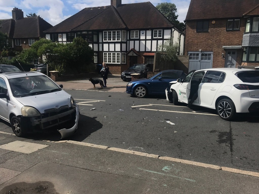
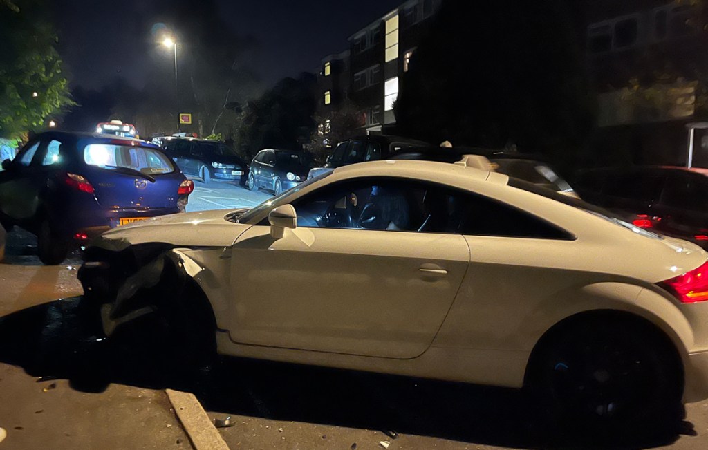
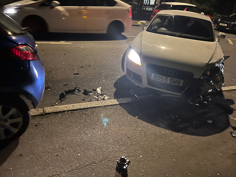
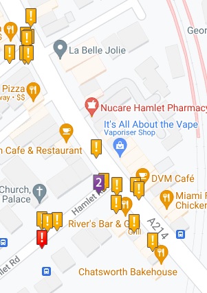
28 April 2023 – Bossing it on Auckland Road:
31 December 2022, to round off the year – crash outside St John’s Church:
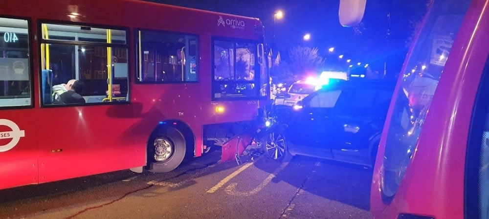
2 December 2022 – at school pick-up time 3:30pm involving three vehicles including a school bus and parked car – all whilst children are walking and scooting from school:
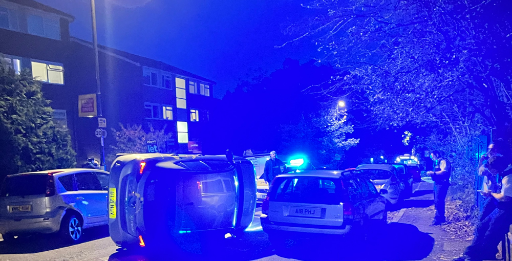
26 October 2022 – car toppled on its side outside entrance to Beaulieu Heights:

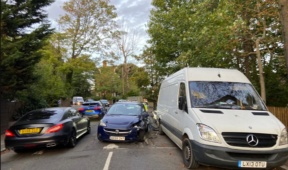
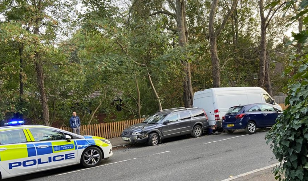
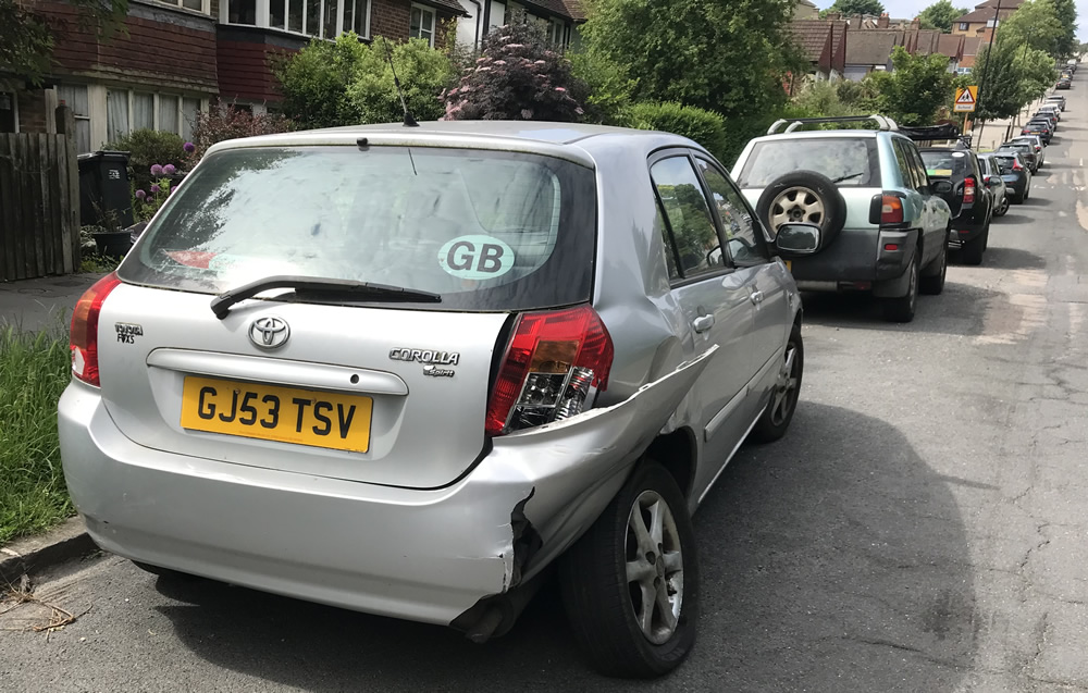
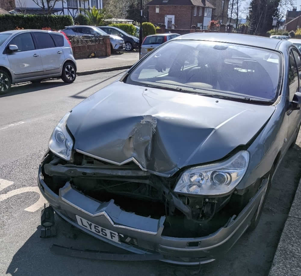
3 October 2022 – Right next to the radar speed sign, a rat-runner shunted a parked Volvo estate car into a white van:
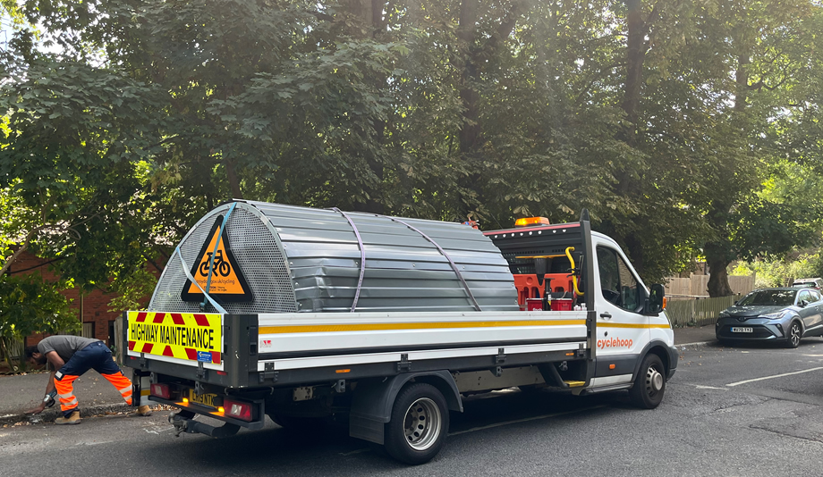
11 July 2022 – removal of crash damaged bike hangar outside entrance to Stambourne Woods, never replaced:
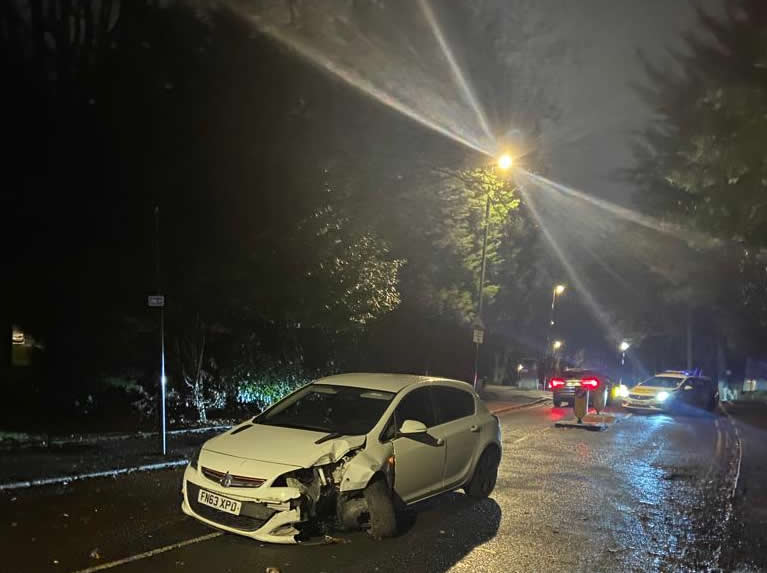
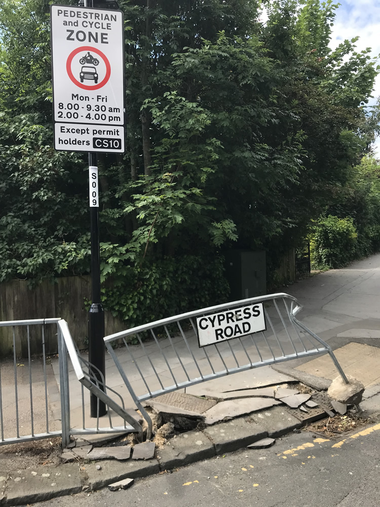
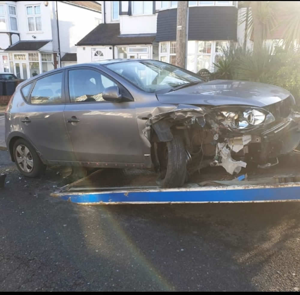
2 June 2022 – car written off on corner of Auckland/Cypress Road:
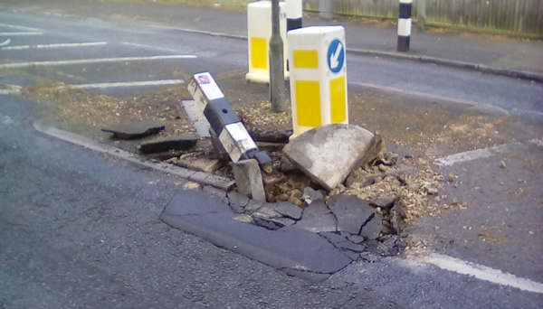
November 2021 – Bollards destroyed outside St John’s:
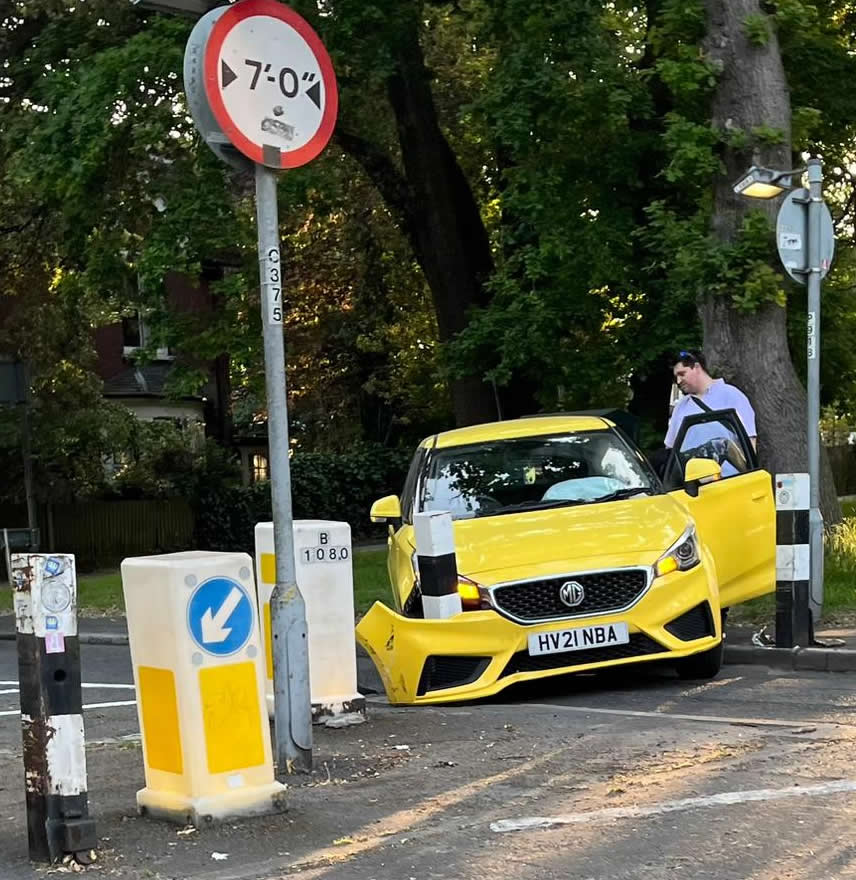
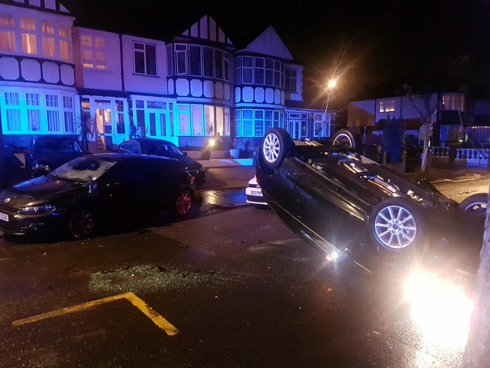
18 November 2021 – Car upside down on Southern Avenue:
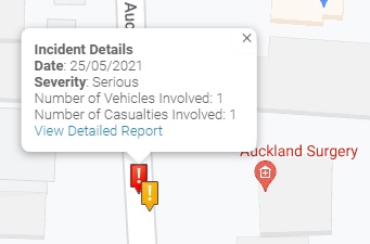
Crash Map
Crashmap [iii] only records personal injury accidents on public roads that are reported to the police, and subsequently recorded, using the STATS19 accident reporting form. Information on damage-only accidents, with no human casualties are not included in this data.
- Serious injury outside Auckland Surgery 25 May 2021
- Crashes are typical at the junction of a rat-run road with a main road
Other factors
Reducing traffic is one of the easiest way for local councils to tackle global warming
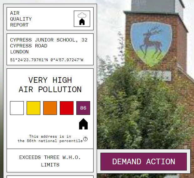
Pollution – according to AddressPollution, virtually all local streets exceed three WHO limits, including School Streets:
Health – Croydon is the worst borough in London for asthma attacks [iv]
One in four children (26%) in Year 6 were obese or severely obese in the 2020/21 school year [v]
The solution (stating the obvious)
- traffic must be discouraged and reduced
- active travel needs to be encouraged
- people will not convert to active travel unless they feel safe
- it’s time to introduce Croydon Healthy Neighbourhood back to Auckland Road and side streets
- an integrated network of safe streets needs to be developed throughout the borough to provide a realistic alternative to driving
- collecting more data and introducing a zebra crossing will not address these problems.
Questions for councillors
- Who is going to actively campaign to address these issues?
- Will you prioritise safety and health over the desire of those who campaign for these conditions to continue?
Bromley council objections
The original LTN had a knock-on effect of rat-run traffic being diverted through Belvedere, Cintra Park, Patterson and Milestone roads (BCPM). This was mostly traffic being diverted by Waze, TomTom etc navigation systems from Anerley Road (a Bromley Road), through BCPM (Bromley roads) to Church Road (a Bromley Road). This could have easily been addressed by Bromley Council introducing a filter, thus upgrading what is in effect an existing LTN (made so by no-entry to Cintra from Anerley Hill).
[i] Speedvisor – January 2019
[ii] Speedvisor – 2 June 2022 8-9am
[iii] Crashmap – providing access to maps and information about crashes
[iv] Evening Standard 1 November 2018
[v] Nuffield Trust 27 March 2023

I just checked, https://www.bromley.gov.uk/traffic-management/road-safety-calming-measures ,
and 30mph seems still to be the “safe”, default, unenforced limit in Bromley. Is Croydon the same?
It boggles my brain to think there is no expectation on motorists to drive slower on narrow roads with parked cars and other hazards.
On the up side I prophesy a massive reduction in car use in Croydon and Bromley over the next 10 years and a consequent diminishing of power for the “drive everywhere” car lobby.
LikeLike