By Angus Hewlett

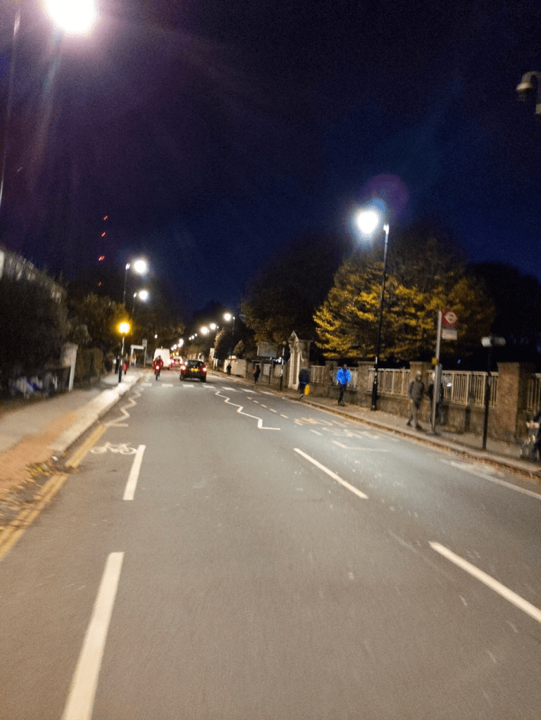
The removal of the scaffolding at the Church Road / Westow Street corner – and with it the long tailbacks on Church Road – contains within it both good and bad news for the future of active travel in and around the Crystal Palace area.
The good news is, of course, that the LTN interventions were not the primary driver of the long traffic delays that the area was experiencing. This further shows that additional LTN interventions are likely to be OK from a network-level perspective in those streets where people are calling for them.

The bad news is that it proves, if proof were needed, just how sensitive the Triangle is to traffic capacity loss, and how bad the knock-on impacts of that can be.
Long-time observers will say that this is not news at all [see Tom Chance, 2014 *]. Whenever there’s a lane outage on Westow Street, or roadworks on any of the approaches, long tailbacks occur. This has been the case for years. But it demonstrates clearly that reducing the Triangle’s ability to carry traffic – with the possible exception of Sundays when flows are lighter – has significant down-sides at least medium-term; however much people might wish it to be otherwise.
At the same time, a number of prominent Triangle traders have expressed their reliance on customers coming from further afield by car. This indicates that removing parking in order to create space for wider pavements or protected cycle facilities is likely to be perceived – rightly or wrongly – as damaging to their interests. The best we can hope for on the Triangle – in the short term at least – is a 20mph speed limits, better pedestrian crossings, and perhaps modest amounts of pavement widening. There is no realistic prospect of a Triangle re-design that allows bikes and trucks to mix at an acceptable safety level.
All this validates and vindicates LB Croydon’s strategy of creating active travel corridors that bypass the critical Triangle junctions. Contrary to assertions in various places, the LTN scheme was not dreamed up on the spur of the moment by residents’ associations, council officials or some unholy cabal of the two: there have been plans at LBC and TfL for an active travel corridor on this route alignment at least as far back as 2014.
The Auckland Road route appears in the “Space For Cycling” ward-level schemes, signed up to by the incoming Labour administration in May 2014; again in the 2016-7 iteration of the “Quietways” programme (where funding was applied for by the council although not granted) and it features twice more – at outline level – in the 2018 “Croydon Cycle Strategy” document and the pre-COVID “Healthy Streets” programme announced in 2019.
But there’s a problem – and it’s not new. The “Quietways” programme – of medium-distance, low-traffic linear cycling routes winding their way towards Zone 1 through the suburbs – was criticised on three main fronts:
Firstly, the process of creating Quietway routes – deploying modal filters (planters and bollards) piecemeal – displaced motor traffic from one quiet, residential road to the next one over. This was not well received by the public. LTNs address this by dealing with small networks or clusters of streets, typically bounded by main roads or other natural barriers.
Secondly, that the long, linear yet indirect routes didn’t fit real-life journey patterns. The main “active travel wins” – that is, opportunities to convert car journeys to active travel – exist for 0.5 to 3 mile journeys. While plenty of commuter cyclists travel much further than this, peoples’ propensity to change established habits falls off sharply beyond that distance. The long trips made by fitness-oriented commuter cyclists tend, on balance, to be made on main roads – for speed and directness; the shorter trips made by locals don’t fit a linear pattern, and aren’t radial towards central London. Again, LTNs – being “blob shaped” rather than “line shaped” – address this problem.
And thirdly: that by actively avoiding major junctions, busy roads and town centres as a matter of design, Quietways don’t actually go to the places people want to go. It’s fair to say that LTNs on their own don’t really solve this. Not only do they not take people all the way to their destination (although they do get close), they actively funnel longer-distance cycle commuters – people with money to spend – away from the commercial centre.
This leaves our traders in a bit of a bind. It’s difficult for many to support cycle infrastructure on the Triangle – anything remotely effective would have too much impact on parking and car journey times – but nor is it easy to support a route that purposely avoids it.
There’s an answer, but it requires me to say something even more controversial, to the people of Crystal Palace than, say, “People ought to use their cars quite a lot less if we want to have a planet fit to live on in twenty years’ time”.
And it’s this.
SPURS! SPURS! SPURS!
(At this point, the writer ducks as a hail of bricks, banana skins and verbal missiles pass overhead).
What we should all be able to agree on – whether we arrive at the Triangle on foot, by car, by bike or on the 432 bus – is that the Triangle itself is best enjoyed on foot. Distances are too short to drive from shop to shop (and in any case the parking arrangements aren’t designed that way); similarly on a bike, you’ll find yourself stymied by the one-way system and relative paucity of cycle parking on our already-crowded pavements. Once you get there, it’s best to walk – and that’s what everyone does. (This is one more reason for not installing protected cycle lanes around the Triangle – they take up a fair amount of street space, and any such capacity as can be reclaimed from motor traffic, is more urgently needed for pedestrians).
So what we need is some spur connectors. A spur connector is simply a branch off a linear route, to connect to something that’s useful, nearby, but not on the main route. In order to work well, it needs to be clearly signposted (at both the junction with the route, and the end of the spur), and built to the same Quality of Service as the route itself.
Case in point: the Triangle is already situated at the southern terminus of Cycleway 17, which winds up the relatively gentle slope of Dulwich Wood Avenue & Farquhar Road to emerge by Cafés Paradou and Saint-Germain. While there have been various sketches and schemes to extend that route across Crystal Palace Parade and on towards the Park, or up the fearsome wall-climb that is Jasper Road and onward via St Aubyn’s, none of these seem to be any closer to reality than they were six or seven years ago when the C17 designers first put pen to paper. A better option in the medium term is to put an official terminus to C17 at the end of Farquhar Road, and provide ample cycle parking and “Legible London” wayfinding for people arriving by bike to continue on foot.
Connecting the LTN’s spine cycle route (designated C29) to the popular Toll Road cycle route at the far side of Crystal Palace Park is a more realistic prospect, because the expensive and difficult bit – redesigning the A212 crossing at Sydenham Hill – was already put in place a few years ago. But, as we’ve explored, this bypasses the Triangle and its upper slopes.
However, while it may be a bypass, its closest point of approach – at the junction of Belvedere Road and Chipstead Close – is just 300 metres from the White Hart corner.
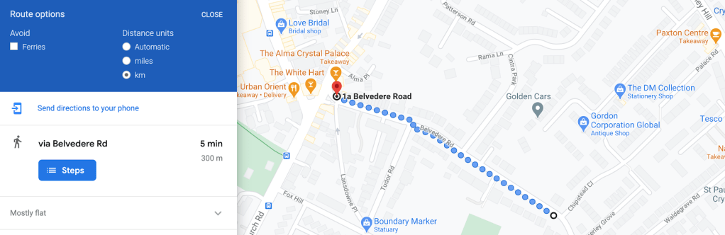
It’s also 38 metres in elevation – the steepest part of the hill at about 1 in 12 – but if you can’t cycle up a gradient that steep, it’s just a four or five minute walk.
So what’s needed to make this happen? A spur connector, comprising five simple things:
- A set of suitable low-traffic interventions around Belvedere Road. We’ve discussed this one before.
- Adequate cycle parking at the Belvedere Road / Church Road corner for people to lock up and explore on foot. This is one of the less pressed corners of the Triangle for space – there are already a couple of Sheffield stands there, more would be easy to fit in if needed.

- A contra-flow allowing cyclists to travel the “wrong way” along the one-way bit of Belvedere Road. This has been done in many similar places and ought not to be contra-versial.
- Clear signposting – as at Farquhar Road – to make passing cycle traffic aware of the connector route and the (tiny) distance involved.
- And finally – some well-sited refreshments to reward those who’ve made it to the top of the Col du Belvedere… I think we’ve got this one covered


Longer term, it’s possible to apply this principle all around the Triangle – as additional low traffic areas and bypass routes are developed to the North and West, similar principles – of spur connectors, wayfinding / signposting and cycle parking at the end of the spur – can be applied to provide convenient access points for active travel on all three sides.
- Tom Chance: Traffic reduction in Crystal Palace and Anerley 4 May 2014
“Without a clear vision like this, we’ll just drift into ever increasing congestion and pollution.”

Congratulations on a much more balanced note than most in this debate.
However, I’d suggest the constraint on this is going to be space for cycle racks, especially if Santander Bikes have to be catered for as well. On that basis the spaces should be found first and the spurs routed to them.
Two obvious locations are the Sainsbury’s car park and the delivery yard, which are both owned by Norwood Heights whose tenants should benefit from the increased footfall.
Spurs also need to reflect the topography. Ideally they would provide both low traffic AND low(er) gradients and would be signposted / publicised as such.
A potential game changer here would be electric bikes, which suggests that the bike racks should also have charging points.
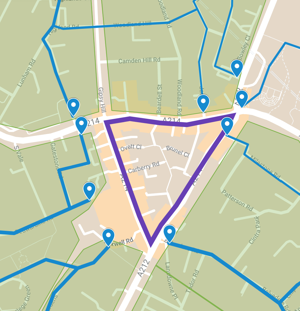
Finally, I live in Highland Road and am confused about the north westerly blue route in your map, which doesn’t follow any road I recognise, which does rather diminish confidence
Having said that I have an idea that would help cyclists using Vicars Oak Road if you want to contact me to discuss.
LikeLike
Excellent point re racks. The top of Westow Park strikes me as another likely spot, and the yard next to Blue Door.
I don’t think Santander bikes are likely to come to Crystal Palace any time soon. Five years away at least. They’re expensive to install and only really work when you have high population density, continuously, over a wider area than we have here. (The Triangle itself is dense, but average population density falls off quite rapidly within a mile or so in most directions). They’re bringing them to Brixton, and I think they could stretch as far as West Norwood / West Dulwich.. here feels like a bit of a stretch.
Electric semi-dockless (designated docking areas marked by paint, signage and tactile paving, and geofenced on the app platform: to prevent street clutter and trip hazards) is the best of both worlds. Low installation cost, flexible reconfiguration, but without all the downsides of pure dockless. And while you might not absolutely need electric on conventional bikes to tackle the hills here, hire bikes trade weight and performance for robust, sturdy construction. Casual riders 100% need e-assist on them here – if it’s harder work than walking, it rather defeats the point.
The start of the north-westerly blue line is Vicars Oak Road. As I’m sure you know, the connections to the east (Woodland Hill etc.) are OK, if somewhat hilly. The railway and Gipsy Hill road rather constrain what’s possible on the north/east side.
Ideally you’d have a route following the contours further northwest, probably Victoria Crescent or Alexandra Drive, aiming for Whiteley Road or so and then Norwood Park, Aubyn Hill etc., there are a few possibilities but I’m aware of the sensitivities around Central Hill right now & don’t really want to drag cycle routes in to that debate.
LikeLike